
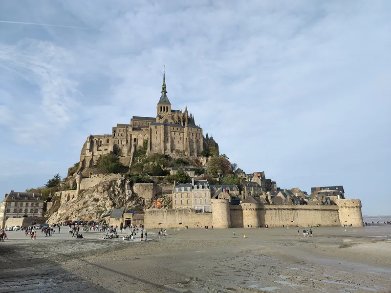
The tides are the reason Mont-Saint-Michel looks like nowhere else in France — and the reason a visit can turn out either breathtaking or disappointing. The difference is simple: whether you arrive in the hour the sea surrounds the rock, or the hour bare sand lies all around it.
This guide is for anyone planning the visit themselves. We'll cover how the tides work in the bay, what the tide coefficient is, how fast the water comes back, where to watch from, when the approach to the rock is closed, and which safety rules here genuinely matter. By the end you'll be able to pick the right day and the right hour.
Because the timing is everything and your window can be short, it helps to have the story with you: the self-guided TouringBee island audio tour opens at the dam with the tides before you even climb up, and runs offline at your own pace. Still deciding on the season? See our guide to the best time to visit.
Still planning the whole trip? Start with our complete guide to Mont-Saint-Michel, then come back here for the tide details.
Tides at a glance
Why the tides are so strong here
Two things at once: a very large tidal range and an almost flat seabed.
The bay is wide, shallow, and funnels towards the shore. Atlantic water pushes into the English Channel (La Manche), meets that funnel, and the level rises higher than usual. And because the floor is nearly level, every metre of vertical means kilometres of horizontal. The sea doesn't wash up a beach — it runs across a flat.
The bay's record was 21 March 2015: coefficient 119 and a range of 14.15 metres. There are two high and two low tides a day, each shifting a little day to day. But what changes most from one day to the next isn't the time — it's the strength of the tide.
The tide coefficient: the key number in the schedule
The strongest tides fall near a new or full moon, when the Moon and Sun pull the water together. The weakest fall near the half-moons. France scores each tide with a coefficient — a number roughly from 20 to 120. The bigger the number, the bigger the range: higher high water and lower low water.
| Coefficient | What you'll see |
|---|---|
| 20–45 | Weak tide. The sea stays far off; sand is exposed all day. |
| 45–70 | Medium tide. A good window for a guided walk on the bay. |
| 70–90 | Strong tide. The water moves noticeably, but doesn't surround the rock. |
| 90–100 | Very strong tide. Water reaches the walls — worth the trip. |
| Over 100 | Grandes marées (great tides). Maximum effect, and maximum crowds. |
One important correction people often miss: the coefficient isn't the only thing that decides. The official services look at the water height in metres and at the weather. An onshore wind adds height; calm weather takes it away. So the same coefficient can give a different result from one year to the next.
Understand the bay, don't just look at it
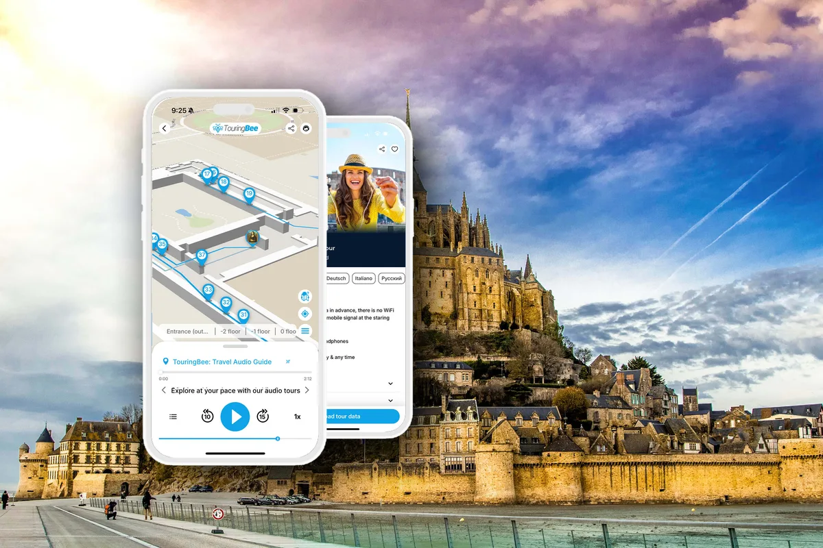
Mont-Saint-Michel Self-Guided Audio TourInstant access
- 100% offline — download before you arrive (weak signal on the causeway)
- Offline GPS map — you start each track yourself at the spot
- 8 languages, real voice narration
- Works on iOS & Android
The TouringBee island audio tour starts at the dam with the story of the tides, before you even climb up — so by the time you reach the ramparts, the whole picture has come together. The offline GPS map works with no internet and shows where you are; you start each track yourself as you reach the spot.
If you want the island fully surrounded by water
Not every tide turns Mont-Saint-Michel into a real island. For most travellers the rule of thumb is simple:
- coefficient below 70 — a pretty but ordinary tide;
- 70–90 — the water clearly approaches the rock;
- 90–100 — the most spectacular views;
- over 100 — the best days of the year, but also the most crowded.
If your main goal is the famous photograph of Mont-Saint-Michel ringed by water on every side, plan your trip specifically around the great tides.
High and low tide: what you'll see
High water gives the classic picture — Mont-Saint-Michel in a ring of sea, with reflections. But the peak is short, so claim your spot early.
Low water opens vast rippled flats. This is the time for guided walks on the bay and for a sense of sheer space. Neither is "better." Many people deliberately build their day to catch both: high water for the view, low water for stepping out onto the sand.
When we were timing our own route along the ramparts, we went up an hour before a strong tide. The water closed off the approach below almost as we watched — the planning paid off.
How fast the water returns
You've surely heard the water comes in "at the speed of a galloping horse" — a line usually pinned on Victor Hugo. The official figure is more modest. The Centre des monuments nationaux, which runs the abbey, puts the wave at about 6 km/h on average. That's a brisk walking pace, not a gallop.
But the warning behind the legend is true. On a huge flat with no landmarks, the water first fills the channels and hollows — and cuts off your way back while you're looking out to sea. The danger isn't a wall of water. It's finding yourself on sand that a moment ago looked safe.
Safety: quicksand and the tide
This is the part to take seriously.
Don't walk out into the bay alone. Ever. There is quicksand — patches that look like firm wet clay until they give way underfoot. The tide traps people here every year, and rescuers have to go out. If you want to step onto the sand, go with a licensed bay guide (Guide de la Baie). Crossings start from the island or from the far shore at Bec d'Andaine. The guides know the safe paths and, above all, the timings.
Watch for fog — it rolls in fast and disorients even close to shore. And don't follow someone else's footprints across the sand; they tell you nothing about what's there now. When in doubt, watch the bay from the ramparts and the bridge: same spectacle, no risk.
Want to step onto the sand safely?
Book a crossing with a licensed Guide de la Baie — they know the safe paths and the tide by heart.
The mascaret: a wave you can see
On the strongest tides a mascaret (tidal bore) appears in the bay — a visible front of water running across the flats and up the river mouths. Sometimes you can hear it. The Mont-Saint-Michel authority's official figure: the mascaret is visible roughly 1 hour 30 to 2 hours before high water. Watch from above — the ramparts or the terraces. There's no need to go near the sand.
When the tide closes access: official 2026 data
Here's a common claim worth correcting. The pont-passerelle (the bridge) stands on piles and does not flood. What closes is something else — the esplanade and the low approach right at the base of the rock. Under the official rules:
| Water height | What happens |
|---|---|
| up to 12.20 m | Normal access via the main gates, Porte de l'Avancée and the Fanils |
| from 12.20 m | Main gates closed; visitors let in via the passage in the rocks |
| 12.70–13.00 m | Risk of the island being cut off, depending on weather |
| from 12.80 m | Esplanade inaccessible |
| from 13.00 m | Full island; movement forbidden |
Heights in the official calendar are measured at the port of Saint-Malo, with a +1 metre correction for Mont-Saint-Michel. Now the specifics. For most months of 2026 the authority's calendar is marked "no risk of the island being cut off." The approach is closed on just three days:
| 2026 date | High water | Coefficient | Approach closed |
|---|---|---|---|
| Sat 21 March | 08:39 | 104 | 08:10–09:10 |
| Fri 14 August | 21:28 | 102 | 21:00–22:00 |
| Sat 12 September | 21:02 | 101 | 20:30–21:30 |
So about an hour each. It doesn't wreck a visit — the window is short and known in advance. But if you're travelling on exactly those days, plan your entry and exit around it. A full island with movement forbidden is not expected in 2026: the highest water in the calendar is 12.79 m, and the threshold is 13 metres.
A side note: the modern bridge on piles and the dam on the Couesnon were built partly so water can flow freely around the rock and flush away silt. That's a story in itself, for a dedicated guide on the bridge and dam (coming soon).
The best viewpoints
From the ramparts and the West Terrace you get the view down onto the water at high tide — the main spot. The bridge and causeway give the classic head-on shot, best early morning or evening. From the shore and the salt meadows by the village of Beauvoir you can frame the rock across the water, with sheep in the foreground. From the flats themselves — only with a guide — you see Mont-Saint-Michel from the floor of the bay at low water.
The French tourism portal France.fr suggests taking your place on the wall about two hours before the peak to watch the water arrive. The authority says the mascaret is visible 1.5–2 hours before high water — so those two markers line up. For lenses and light, see our photo-spots guide (coming soon).
How to read a tide table
A Mont-Saint-Michel tide table lists, for each day: the times of the two high and two low waters, the heights in metres, and the coefficient. The order of operations is simple:
- Pick a date and check the coefficient.
- Look at the water height in metres — that matters more than the coefficient.
- For the "island in water" picture, be on the wall 1.5–2 hours before high water.
- For a walk on the flats, take the hours around low water and a licensed guide.
- Check whether your day falls on the great-tides list — it'll be busy.
Official sources: the Mont-Saint-Michel authority's tide calendar on montsaintmichel.gouv.fr, the tourist office's tides page, and the French hydrographic service SHOM.
A planning example
Say you want to see the rock ringed by water on a Saturday. You open the 2026 calendar and find: 12 September, Saturday, coefficient 101, height 12.79 m, high water at 21:02. It's one of the three days the approach is closed — from 20:30 to 21:30.
So the plan is: go up onto the ramparts around 19:30, claim your spot, watch the water come in, and leave after 21:30. You also get evening light and fewer people. If instead your day has a low coefficient, flip the plan: come at low water, walk the flats with a guide, and save the "island in water" shot for another trip. The schedule decides for you. All you have to do is read it.
Practical tips
- Don't just check the time — check the coefficient and the water height too.
- Get to the wall early; the peak is short.
- For a bay walk, book a licensed guide and go around low water.
- Don't treat footprints in the sand as a safe path.
- Bring a windbreaker — the bay is open and it blows.
- Watch for fog, and always keep your own tide time in mind.
- The car park is 2.7 km from the rock, with the free "Le Passeur" shuttle to the entrance — build that time into your plan.
Common mistakes
Turning up at low tide and waiting for "the island in the sea" without checking the schedule. Walking out onto the sand alone to get closer. Looking only at the time and landing a flat, unremarkable tide. Assuming access is normal on the very biggest tides. And arriving on a great-tide day and being surprised by the crowds.
Where to watch a strong tide come in
If you want to see the water gradually surround Mont-Saint-Michel, go to the ramparts or the West Terrace about an hour and a half to two hours before high water. If your goal is photographs of the island itself, the good spots are before the bridge, on the car-park and dam side — from there you clearly see the sea cutting the rock off from the mainland. Don't keep moving around waiting for the tide; it's far more rewarding to watch the whole process from one place.
Frequently asked questions
When is high water at Mont-Saint-Michel?
Twice a day, with the time shifting each day. Check a tide table for your date. For the "island in water" picture you need a strong tide with a high coefficient.
When is the island surrounded by water?
Only on the strongest tides. In 2026 the highest coefficients are 18 April (105), 20–21 March (104) and 12–14 September (101–102).
Does the bridge flood?
No. The bridge stands on piles. What closes is the esplanade and the low approach at the base of the rock. In 2026 that happens three times for about an hour: 21 March, 14 August and 12 September.
Is it safe to walk across the bay?
Only with a licensed bay guide (Guide de la Baie). Quicksand and a fast tide make walking out on your own dangerous.
What is the tide coefficient?
A French score of tidal strength, roughly 20 to 120. The higher it is, the bigger the range. But the final call on access is made on the water height in metres and the weather.
How fast does the water come in?
About 6 km/h on average, per the Centre des monuments nationaux. A brisk walking pace, not the gallop of legend.
Continue exploring
The takeaway
The tides are Mont-Saint-Michel's daily performance. A few minutes with a table decide which act you'll see. Want the island in water — take a day with a high coefficient and get to the wall early. Want quiet and space — take the hours around low water. But never walk out on the sand without a guide.
Read the water first. The rest of the trip falls into place. And if you'd like to understand what's happening in the bay rather than just watch it, the TouringBee island audio guide begins at the dam with the tides and carries the story all the way to the abbey doors.
Some links on this page are affiliate links (GetYourGuide, Tiqets, TouringBee). If you book through them we may earn a small commission — at no extra cost to you. It never affects what we recommend. See our Affiliate Disclosure.